"Pennsylvania," say AT thru-hikers, "is where boots go to die!"
All the while I had been finishing up with my incessant editing on Graham’s and my trail challenge blog, I had been wondering how I would find time for a similar journey I could do with Clayton. Clayton had been born right when Graham and I were in the middle of our trail challenge and it immediately became clear to me that all of the wonderful memories I’ve had with Graham while hiking awaited me with Clayton as well. I also felt like I got to know Graham on an entirely different level during our hikes so I really looked forward to doing the same with Clayton.
I had initially considered doing the trail challenge again, with Clayton this time, but thought that there would be too many associations between these hikes and memories with Graham. I also didn’t look forward to all the driving required to complete the required downstate hikes. Besides, all the time Graham and I had been hiking in flat Delaware, a desire to hike more exotic terrain burned inside me. If Clayton and I were going to go on some hiking adventure together, it was clear that new, more challenging trails awaited us.
During the summer, I took Clayton on some short, local hikes in an attempt to get my hiking legs back as well as to test Clayton’s acceptance of the backpack. Clayton had been hesitant about riding in our bike trailer so I wasn’t sure he would take to the backpack. Fortunately he not only accepted it, he seemed to really enjoy it. He absolutely loved the short, local hikes we went on. With Clayton seemingly up for the challenge, I knew that if we were going to have a similar kind of bonding experience along the trail, it would have to happen either before winter or next spring. He was at the same magical age as Graham had been during our hikes (able to comprehend while still light enough to carry) and because kids change so rapidly during their early years, I realized it would have to happen sooner than later. I soon was not only thinking about it, I began stressing over getting it in before winter.
I do not recall how I first learned of Pulpit Rock and “The Pinnacle”, and the hike which crosses both, but I ultimately decided this would be our hike. These are considered two of the best vistas along the Appalachian Trail in Pennsylvania and the hike is long enough to provide Clayton and I ample alone-time along the trail. We would not only do the hike, but would turn it into a weekend getaway for just the two of us. The hike seemed to have just about everything we could want as it mostly follows the Appalachian Trail (which I’ve long hoped to hike sections of), consists of a loop (essential for a day hike), has a decent amount of elevation gain, includes two excellent vistas, and is less than a two hour drive from home. It is described as a “moderately difficult” 8.7-mile loop with 1500 feet of elevation gain. Now Graham and I had hiked probably nine miles in one day before, but this had been over multiple hikes and on flat terrain. A single nine-mile hike with 1500 feet of elevation gain was another thing entirely. I had also been in much better hiking condition when Graham and I tackled our longer hikes. This, as well as my plans to camp overnight near the hike with Clayton, had me somewhat concerned about what could go wrong. Though the questions surrounding our adventure were dissipating, I began to stress over the details even more.
I had begun preparing as best I could by researching the hike online. There were mentions of some steep, rocky sections early in the hike and I became concerned about carrying Clayton on my back over such dangerous terrain. I had scaled some steep hills with Graham before, but I didn’t want to get 2-3 miles into a hike only to find a section impassible for us. As with almost anything, though, spending too much time reading the internet can make you worry about anything and I decided that we would just have to see it for ourselves. All we would then need was a free weekend, some good weather, and a solid commitment to go for it.
A dry summer dissolved into record rainfalls during August and September. It seemed to be raining every other day. Finally, during the first week of October, a beautiful weekend was forecast so I decided to make plans. I called a campground I had reconnoitered at the bottom of the mountain we wanted to hike and was horrified to learn that they were already booked for the weekend. I had apparently underestimated the popularity of the region. I called two more campgrounds with no luck. Finally, ready to give up, I called one more, which was located about thirteen miles away and found a vacancy.
I took Friday off from work, loaded the car, and then picked Clayton up early from School. As we were leaving the school, I felt the first bit of guilt over not taking Graham with us. I knew this was supposed to be Clayton’s turn, but it didn’t help ease my conscience. I was leaving my first hiking buddy behind for the first time and it hurt.

I kept thinking that everyone would be perfectly happy if we just stayed home and enjoyed a nice, relaxing weekend unwinding from work and life. Why was I putting us into a situation which created so much anxiety? Did these thoughts mean I was going soft or perhaps wound too tight? I refocused my eyes off of the ridge and into the beautiful blue skies in an attempt to refocus my mind and straighten myself out.
After getting a little lost amongst the rural farm fields (my GPS kept telling me to turn down what looked like private farm roads), we finally found our campground. The campground was located about thirteen miles west of where we would hike, but was nestled along the base of the same ridge. I woke Clayton when we arrived and checked in with the office. Clayton had that just awoken, confused look on his face and I couldn’t help but feel a little of the same. I guess I’ve become so accustomed to family getaways that it felt awkward and strange to be alone with only Clayton at a foreign campground. We also usually camp at state parks and this was a family owned, mostly seasonal campground. The majority of the sites were for seasonal RV’s and trailers and everyone else there seemed to know each other, making us feel like outcasts.
 We found our site and set up our tiny little 2-person tent, which consumed only a fraction of the tent pad. We were located across the road from the other tent sites and I couldn’t help but feel not only like an outcast, but like a runaway father hiding from the law. All the other sites were occupied by large groups, most of which spent their time sitting around a camp fire and laughing out loud. Clayton and I, with our little tent and no campfire, had to look odd and I could almost feel the eyes upon us. I was still struggling to let go and enjoy the moment but Clayton seemed as relaxed as could be.
By the time it started to get dark, I began preparing our dinner. I cooked some noodles on the stove and Clayton and I split them. Though I was feeling a bit anxious about our accommodations and the hike the next day, Clayton was not only relaxed, but seemed to be having a ball. One of my concerns had been whether he would suddenly decide he no longer wanted to camp or would decide there was no way he was getting into the backpack. He wears his heart on his sleeve, as they say, and surely wouldn’t hide his feelings if he was bothered by something. His mood during dinner, though, eased much of my concern about his spirits. He didn’t appear to have any discomfort or unease and this helped move my thoughts towards the positive as well.
After we finished dinner, I turned on the car radio (I had forgotten to take a portable one) and tuned in Game 5 of the divisional playoff series between the Philadelphia Phillies and the St. Louis Cardinals. The Phillies had failed to win the series a few nights before and now I was stuck trying to follow along through AM radio while camping in the mountains. By then it was after 8PM and I wasn’t sure how long I would be able to follow along since I really wanted to wake up early the next day so we could get an early start to our hike. The game was supposed to start at 8:05, which already annoyed the hell out of me because despite starting every home game during the season at 7:05PM, the television networks insist on the games airing live during prime time. This usually means that you have to stay up past 11PM if you want to see/hear the entire game. I was hoping to at least follow along for a few innings before retiring but when I heard the announcer mention that the teams had just finished batting practice. I turned the radio off in disgust and decided that there would be no more external distractions. This was Clayton’s getaway with me and I wasn’t about to spend half the night sitting in my car listening to a baseball game. I would have to wait until morning to find out whether the Phillies would advance to the next round. (They didn’t – glad I didn’t listen!) I changed Clayton into his pajamas and we retired to our sleeping bag. We set our alarm so we would rise before dawn and while listening to the other campers whoop it up around their campfires, we slowly fell asleep in the crisp autumn air.
Despite our early bedtime the night before, the alarm was still an unwelcome intrusion when it sounded before dawn the next morning. It was still dark and the temperatures had dropped during the night and this was no encouragement for us to get out of our warm sleeping bag. Clayton had tossed and turned throughout the night, but was now laying snug up against me. We were warm and cozy and the thought of waking and making a quick breakfast didn’t seem like much fun.
We coerced ourselves to get up and dressed, but despite my best intentions, we still didn’t get on the road until 8AM. After breakfast and a trip to the restroom, we were running much later than I had hoped. I had read that parking at the Hamburg water works facility was somewhat limited and that the hike was very popular, so I was hoping to get there early and beat some of the crowds along the trail. We pulled into the parking area and I was dismayed that almost all of the parking “spots” were taken. There were plenty of other places to park, though, and others were already filling these up as we found some space along the lot’s exit.
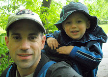
There were many groups of people buzzing about, readying themselves for their hikes and I unloaded Clayton and began to ready our gear as well. I unloaded the backpack and as soon as Clayton spotted it on the ground, he began trying to climb in. He started saying, “need help, daddy…need help”. He was pumped and ready to go. I began gathering our trail maps, food, water, trekking poles, camera, hats, diaper bag, and seemingly endless other items I thought we might need while hoping not to forget anything important. I really didn’t know how to judge how much water to take with us. Ideally, you take more than you think you’ll need but water equals weight and I would already be carrying greater than forty pounds. I loaded seven bottles in the backpack and then one in my front pocket for good measure (and easy access). I strapped Clayton into the pack, mounted him onto my back and we started on our way.
Not knowing what difficulties the trail held in store for us, I was extra mindful of people’s expressions as we passed by them in the parking area. We definitely got plenty of looks but I couldn’t tell if they were the, “awww, look at the little kid” looks or, “what is that guy thinking?” looks. I was hoping that we wouldn’t turn out to be someone’s future story – “remember that idiot who tried hiking up to Pulpit Rock with his kid on his back, and how everyone had to help him down?”. Even as we were about to hit the trail, I was still having second thoughts.
From the parking area, we passed through a yellow gate and followed an old road uphill towards an intersection with the Appalachian Trail. I wasn’t sure how far along the road the intersection would be so we kept a close eye out as we hiked. Soon, we could see an older gentleman up ahead, heading down the trail with his dog. Despite the crowds we encountered in the parking area, this was the first person we had seen on the trail. As we met, I asked him whether the white trail lay ahead, for which he responded, “The AT? Yep, just ahead is a clearing and the intersection. You’ll cross a bridge and then follow to your right”.
 We soon came to a large clearing and sure enough, there was a large, wooden sign signifying that we had reached the Appalachian Trail. The clearing is situated at the site of the old Windsor Furnace, which was an iron furnace built back in the 18th century. Nothing of it remains, though, but the name remains as that of an overnight shelter along the trail. The sign was our first real photo op and Clayton and I posed alongside it as I did my best to take our own picture. The sign indicated which direction was north and which was south. It also indicated miles to significant points, namely the beginning and end of the trail. Springer Mountain, Georgia, the start for northbound hikers, is 1201.4 miles to our south, and how disheartening it must be for thru-hikers to see that Mt. Katahdin, in Maine, is another 965.7 miles to the north. My mind was occupied with what lie ahead over the next ten or so miles, so we moved on.
After crossing Furnace Creek, we immediately saw our first “white blaze” - a roughly 2-inch x 6-inch white paint on a tree - indicating that we were officially on the AT. We worked our way along the trail, still alone and wondering where everyone else was. I knew there were two ways up to Pulpit Rock. One was along the AT and the steep climb up the face of the ridge and the other was a gentle, constantly rising gravel road leading up to an astronomical observatory at the top. While I was still apprehensive about the challenges which lay ahead on the AT, I knew we weren’t going to chicken out and follow the gravel road. With greater risk comes greater reward and there was no way I would live with myself if we took the “easy” way up without even giving the hard route a try.
 The AT follows rocky ground while rising gently for a while and it was here, before we even encountered any difficult terrain, I lost my footing and crumpled to my knees. While I somehow managed to keep from falling completely (preventing Clayton from hitting the ground), I was a little spooked by our fall. During all the hiking I had done with Graham, I never had a fall. Here were Clayton and I less than a mile into our hike, with trekking poles no less, and I had already gone down. Though I was unscathed physically, I was a tad rattled and hoped this wasn’t a bad omen as we gathered ourselves and continued ahead.
The flat ground soon turned upwards as expected. While my effort increased, we were still making good progress. We soon caught, and passed, an older couple along the trail. They stopped to the side as we passed and the man looked at me with a serious face and said, “Hey buddy! You’ve got someone following you!”, referring to Clayton. As was my experience with Graham, almost everyone you pass on the trail offers a comment when you’re carrying a kid on your back, but I thought this comment was one of the best (his facial expression sold it). The couple then watched as we passed, in seeming admiration of our progress.
The trail really started to climb after this. I could feel my heart rate rapidly rising as my legs quickly fatigued. I soon felt my effort matching my maximum, similar to climbing a steep hill on a bike. Though I had no idea how difficult the trail would be, I had set a goal for myself before we started to not rest until we reached Pulpit Rock. But I was quickly losing confidence in sustaining this goal and wasn’t sure how much longer I would be able to go. I only stopped long enough to gulp down some water as I was already sweating heavily. It was also starting to warm up and I was still wearing a long sleeved shirt, which was not easy to remove with the backpack on - and I sure wasn’t going to stop to remove it.
We continued climbing and as I wondered just how much higher we needed to go, we came upon another group of hikers resting alongside the trail. This was a group of about 6-7 young and fit looking people and I could see their expressions change as they noticed Clayton riding along in the pack. They all stared at me as I approached. To break the silence, I muttered a sarcastic and out of breath, “any more climbing left?”, while doing my best to look unbothered and fresh. I kept moving as we passed them and used this catch as motivation to continue on and not let them catch us. Immediately after passing them, though, we turned a sharp corner as the trail rose even more steeply, further testing my resolve. When cycling, I hate taking breaks during climbs and try to motivate myself to make it to the top in order to “earn” a break. I used similar internal motivation to keep me going up the trail, hoping that we would earn our first real break. Clayton, meanwhile, sat silently in the pack. He was probably wondering if his old horse was going to make it.
 The trail finally began to level off some as we came upon a boulder field – a leftover over from the last glacial period, over 10,000 years ago. The boulders are quite a sight after hiking through dense woods. The rocks closest to the trail are dark and spotted with moss while the rocks higher up on the slope, out of the tree canopy, appear to be bleached white from the sun and really brighten up the surrounding woods.
While the massive boulders offered a fascinating sight along our right, the trail thankfully follows flatly around them…at first. This relief wouldn’t last and the trail soon begins to ascend again. We then encountered an unmarked fork in the trail and weren’t sure which way to go. I couldn’t see any blazes in either direction, so I pulled out our maps and began to examine them. I soon heard voices coming up the trail from behind and could see a young couple approaching us. When they reached us, they studied the intersection as well and the guy soon discovered a white blaze to our right. Clayton and I followed behind them as we immediately began ascending up, now through the boulder field, following switchbacks through the steepest section yet.
 The trail began ascending steps cut in the rocks and each step I took seemed to sap all of my energy. I could hardly believe that the trail actually followed up such a steep incline and I merely put my head down and took one step at a time. The girl in front of us looked back, seemingly concerned about us, and asked if we needed help. She was obviously hoping we wouldn’t, because there wasn’t much either of them could do, but knew she had to ask. I told her we’d be fine and would just take it slow, for which she responded, “good idea”. They soon moved ahead of us and a few minutes later, I looked up to see where the trail continued and was shocked to see the couple high above us, confirming just how steeply the trail climbed. With the weight of the pack on me, it felt like I was being pulled backwards each time I took a step up. Only when pausing for breath did I take a glimpse back and marvel at how high we had climbed. One misstep here could be dangerous for Clayton so I took our time.


 There were only two men here when we arrived. Covered in sweat and out of breath, I looked out over the valley below us and could only mutter, “Wow”, as they greeted us with hellos. The view was truly earned. Clayton, on the other hand, missed all of the fun we had gone through getting there. He slept through the steepest sections and final climb through the rocks. I wouldn’t let him miss the views, though, so I dropped my pack, woke him up, and pulled him out. He rubbed his eyes as he looked out, off the mountain. His face seemed to have a “how did I get here” look, while also indicating an appreciation of the view. The two men asked about the trail we followed up and indicated that they had followed the road. Soon, a large group of people emerged from the road as well and we would not be alone for the rest of our hike.
 Clayton turned out to be a popular person at Pulpit Rock. By the time I had him awake and out of the backpack, people began cooing over him. He was having a snack on one of the rocks and a few people even asked if he hiked up himself. I wouldn’t have believed they were sincere, but they sounded as if they were. Maybe they hadn’t believed that I had carried him up, prompting their questions. Most expressions seemed to imply the question, “how did he get here?”.
 After Clayton and I finished our snacks, we packed back up and set off along the ridge towards The Pinnacle, following behind a large group. I hadn’t realized that this group was setting off at the same time as us and would have hung around the peak a little longer if I had. It’s difficult to hike directly behind or even directly in front of people as everyone has their own pace. Generally, Clayton and I would be the slowest on the trail, but this was a large, chatty group, so I had a feeling we would be tailing them closely. To help get some distance between us, I stopped to take some pictures. It was then that I realized we had been so focused during the early part of the trail that we hadn’t taken many pictures at all.
 Though the majority of the climbing was now behind us, the rocky terrain continued along the ridge and helped to slow our progress as well. Some sections were merely fist sized rocks, but there was another crossing of a small boulder field to contend with. We were becoming experts at crossing the large rocks at this point, though, so we hardly lost a step. We soon caught up to the large group that set out in front of us. They were stopped in the middle of the trail, with the two men who were at Pulpit Rock when we arrived. One of the men was playing his guitar and singing a song. As we approached, the group of young people looked at Clayton and I with a kind of uneasy embarrassment and I said, “Hey, live music – is anyone serving beer?”. I then realized this wasn’t merely an old folk song sing-a-long, but a good ol’ Christian hoedown. One of the younger members of the group came back and told us that we could continue through, almost as if we were interrupting some secret seance, but since we would have to nudge our way through the group to continue on, I said that it was ok as I didn’t want to be rude. We spoke briefly and he told us how they just met the two men along the trail. The rest of them were from a church in Bucks County. They were all very nice and we chatted a little while longer until the song was finished. Clayton and I used the break in music as an opportunity to resume our hike. As tough as the hiking was with the heavy pack, standing still was worse so I was ready to get moving again. We were once again alone on the trail, ahead of the others, and free to hit our stride. We moved briskly, but were eventually caught and passed by a small portion of the group. We would continue to run into our new friends throughout the rest of our hike and they affectionately referred to us as the “father & son team”. Every time they would take a break along the trail, we would catch them. They took our catch each time as a prompt to move along. It gave me some reassurance, knowing that should we have any difficulties, help wouldn’t be far away.
 When I had read about the hike beforehand and about this ridge that we would cross from Pulpit Rock to The Pinnacle, I had hoped for some scenic sections along the trail here. While we could see the ground rapidly descend at points along our right, indicating that we were on the ridge, the woods were so thick that they blocked any views of the valleys below. Since there wasn’t really much to see, all we could do was concentrate on the hike. So I seemed to drift back into a focused mindset while crossing the rocky ridge and before I knew it I could hear more people up ahead. I lifted my head to see where the noise was coming from and noticed we had reached the large rock cairn marking The Pinnacle. Hikers reaching The Pinnacle add a rock to the cairn and it’s hard to believe there are any rocks remaining on the trail near this thing because it is enormous. I picked up a small rock and handed it to Clayton to throw in. He commented, “chicken nugget”, at the rock (maybe he was hungry?) and then when prompted, added it to the cairn. Maybe someday, I thought, he’ll bring his child up here to add theirs.
 The Pinnacle consists of a long, rocky ridge at the top and end of the mountain ridgeline. The ridge continues to a point, and then doubles back on itself. On the right side of the ridge, the Lehigh Valley, with its hills and farmland, can be seen below. On the left side, through some narrow woods, another boulder spill follows down the side of the mountain and Hawk Mountain can be seen across a small valley. The ridge of nearly solid rock on the right is the popular destination, though, and was already beginning to fill with people eating their lunches.
 Clayton and I followed along the rocks, looking for a place to settle. I was amazed at the number of people already here since the only people to pass us along the trail were a small portion of the church group. I thought we were essentially leading almost everyone across from Pulpit Rock, but I later learned that most of the people had followed a different trail up, which would be the trail we would follow down. I even saw a couple walking across the rocks in cycling clothes and shoes. I spotted their mountain bikes later. Of all the crazy looks we had been receiving, I thought that those cyclists were the real nuts on the mountain.
 We finally found a quiet place along the rocks, back from the ledge a little, and I started to remove the pack to let Clayton free. As I started loosening the straps, I looked down and noticed a narrow cave in the rocks, about two feet from where I was standing. I tried peering down inside to see how deep it was, but I couldn’t see the bottom. Therefore, I decided this wasn’t the best place to set Clayton down and we moved to a safer spot. An older gentleman, who was eating lunch on a nearby rock, saw me looking into the cave and told me that it was large enough to climb down into and follow out to the ridge. He said if one is bold enough, the cave can be followed very deep down and mentioned some stories from his teen years which he said now make him shudder.


 Clayton and I started eating our lunch in the warm sun while enjoying the beautiful views in front of us. Since we were staying about fifty feet away from the edge of the ridge (I didn’t want to hike back alone!), people began filling in the spots in front of us. It didn’t matter, though, because the views were plentiful. The skies were bright blue and numerous hawks could be seen circling out off the ridge. The birds would occasionally dip down below the ledge, emphasizing how high up we were. The summit here was only 1600 feet in altitude, but compared to all of the hiking I had done in flat Delaware, it felt high. More people continued to fill in as we ate our lunch and occasionally we would spot those we passed on our way up, through the steep sections along the early part of the trail. They would smile with comments such as, “Hey! You made it!”, as we shared a camaraderie of knowing we took the hard way up.
 We were enjoying ourselves and were so relaxed that we ended up spending nearly one and a half hours on the ridge. Clayton, especially, was having fun. He was comfortably moving around “our” rock and would occasionally get upset if someone crossed it. He was also taking in all the compliments that were coming his way. People were treating him like a rock star and he loved it.
We eventually decided that we should move on and as I was preparing the pack for Clayton, I decided to take a few pictures of him posing in front of a trail log mailbox, hanging from the side of a tree. These trail logs are located all along the AT, primarily at the shelters for thru-hikers, and I thought this would provide for a great picture. I stood Clayton on a small rock below the mailbox and handed him one of my trekking poles as a prop. As I was staging the photo shoot, people began gathering around and I could hear more, “awww, how cute” comments from behind me. Yes, Clayton turned out to be a little celebrity up on that ridge. If only he were older he would appreciate all the college girls cooing at him.


On our way back from the ridge, we wandered over to the other side of the point to check out the views of Hawk Mountain, located to our north. We then resumed back towards the AT and passed the large rock cairn, but as soon as we passed the cairn, I was no longer sure we were on the correct trail. I wanted to be sure we weren’t heading back the way we came, so I began studying my maps. I eventually asked a couple approaching from the other direction and still wasn’t able to determine with absolute certainty that we were heading the right way. As we eventually decided to continue on and try to determine our direction further along the trail, our old friends from the church group came along and confirmed we were headed in the right direction. Since we didn’t want to hold them up, we allowed the large group to pass and we once again followed along behind them.
The path back down, which continues along the AT, is a gently sloped and wide trail and really quite boring when compared to the hike up. If the majority of the people up at The Pinnacle had followed this path up, they missed all the fun.
We passed a small clearing with a fire pit where people could camp and I imagine this would be a really cool place to stay the night. It’s proximity to The Pinnacle would allow you to watch the sun set off of the ridge and then wake early to see it rise again. Especially on a day like we were having, the sunset and sunrise must have been a breathtaking sight.
The relatively featureless trail we followed back from the ridge provided for a monotonous stroll and was only interrupted by passing people on their way up. We passed a few scouts, and then later their fathers, heading up with camping gear on their backs. As things began to quiet down, I could now focus on other things and could feel my shoulder begin to bother me. Despite this, I was amazed about how well I felt at this point. I had been concerned about how well I would hold up on such a long hike with a heavy pack, and especially along the steep terrain. With only a few hikes under our belts during the past summer, I was far from optimum conditioning. I attributed my shoulder pain to the trekking poles (perhaps I had them adjusted too high), so I stuck them both in one hand and tucked my hands into the chest straps of the backpack, as I would frequently do when hiking with Graham. We were on relatively flat ground now and I didn’t need them. With my hands tucked into the straps, my elbows were positioned off to my sides, slightly behind me. Seeing this, Clayton decided that it would be fun to start kicking them. He apparently was intent on being sure some part of me would be aching at the end of the day!
 We once again caught the church group just as we reached a helicopter clearing along the trail. The helicopter clearing is a landmark of sorts, indicating an intersection with the “blue trail”, which would take us off the AT and lead us back down to the reservoir. The presence of Furnace Creek, running alongside the blue trail, helped break the monotony of our trip down the mountain. The trail began to descend more steeply here (requiring me to put the trekking poles back in use), so the creek follows an adventurous route down. At times we would see the creek running just alongside the trail, only to find it more than fifty feet down a steep hill, roughly one hundred yards later. This produced many small, picturesque waterfalls along the creek. Clayton and I began taking frequent detours to check out the creek, putting some distance between us and the large group in front. Clayton soon used this quiet to take another nap and I was now a little jealous of him.
 With most of our excitement behind us and Clayton sound asleep, little aches and pains began to command more of my attention and I began to primarily think only about finishing the hike and getting back to the car. I still had to watch every step, though, as the trail was covered in loose rock and I could easily lose my footing. I still had good energy, but that too began to wane and a little pain in my knee began to get worse. I usually do not mind “fighting through” pain, but this was the same knee I injured playing hockey a few years earlier, so it had me a little concerned. Nothing had bothered me on the way up through the steep, strenuous sections, but the constant pounding on my joints on the way down was beginning to wear on me. It was during this trip down the loose and rocky trail that I really appreciated my trekking poles, despite how nerdy I had felt carrying them earlier in the hike.
We soon reached the reservoir, which provided a bright, pleasant view, and also indicated that we had nearly completed our hike. These open areas can be welcoming after hiking for hours through the confining woods. Clayton woke up as I was taking a few pictures and despite me beginning to feel the effects of the long hike, I began to get a little sentimental that our journey was almost over. While I had been apprehensive about what the hike had in store for us when we began, it was now leaving me wanting more. Clayton’s mood seemed to indicate that the feeling was mutual. While Graham enjoyed himself during our hikes, long periods spent in the pack would bother him. He would eventually want out to hike on his own. Clayton, however, never once asked to get out of the pack. He has always enjoyed being held and it seemed the backpack provided him the same comfort. The sight of the reservoir, and its symbolism as the end of the hike, gave me a lift and I almost felt as if we could go on for hours more.
We followed the trail down from the reservoir, past the AT intersection, and back to the parking area. It was very quiet here, but cars were parked everywhere. When we arrived in the morning, it seemed like the majority of the crowd had arrived before us. Now we could see cars parked anywhere there was space and along both sides of the road leading in for another half mile or so. I was glad we arrived when we did.
Clayton had been pretty quiet during the hike, but the sight of the cars elicited him to shout, “We did it!”. I remembered how Graham had surprised me with a similar, “We made it!”, a few times during our hikes and I was just as surprised that Clayton recognized our achievement. Though they sit quietly in the backpack for hours during the hikes, they really do take in and are aware of more than I would ever imagine. Whenever I think I am involuntarily dragging Graham or Clayton along on these adventures, these cheerful responses let me know they are following eagerly along.
We both had a blast and likely an experience to last a lifetime. Was I ever glad I didn’t decide to spend a weekend “relaxing” at home.